|

|


4911 FM 1960 Rd W 17,068 SF Retail Building Houston, TX 77069 For Sale
INVESTMENT HIGHLIGHTS
- Free standing building
- 16,667 sf on 1.63 acres
- No Zoning
EXECUTIVE SUMMARY
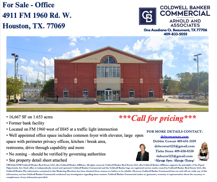
16,667 SF on 1.653 acres
• Former bank facility
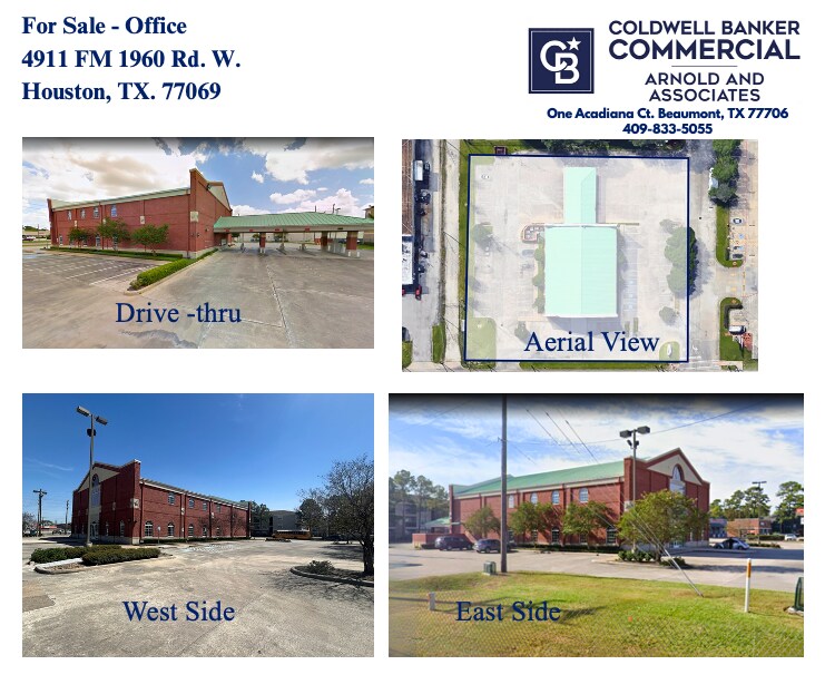
• Located on FM 1960 west of IH45 at a traffic light intersection
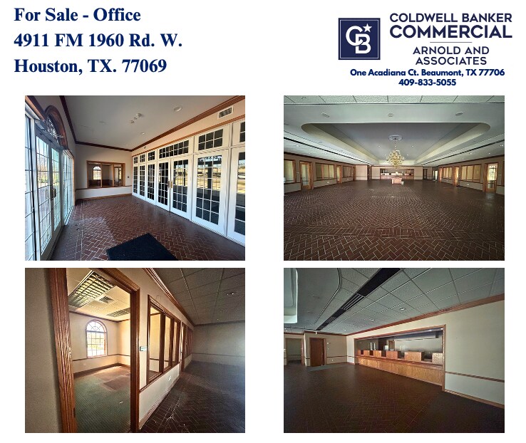
• Well appointed office space includes common foyer with elevator, large open space with perimeter privacy offices, kitchen / break area, restrooms, drive through capability
and more
• No zoning – should be verified by governing authorities
• Former bank facility
• Located on FM 1960 west of IH45 at a traffic light intersection
• Well appointed office space includes common foyer with elevator, large open space with perimeter privacy offices, kitchen / break area, restrooms, drive through capability
and more
• No zoning – should be verified by governing authorities
PROPERTY FACTS
Sale Type
Investment or Owner User
Property Type
Retail
Property Subtype
Building Size
17,068 SF
Building Class
B
Year Built
2000
Tenancy
Single
Building Height
2 Stories
Building FAR
0.24
Lot Size
1.65 AC
Zoning
N/A - Should be verified with the city of houston
MAJOR TENANTS
- TENANT
- INDUSTRY
- SF OCCUPIED
- RENT/SF
- LEASE END
- n/a
- Finance and Insurance
- 100 SF
- -
- -
| TENANT | INDUSTRY | SF OCCUPIED | RENT/SF | LEASE END | ||
| n/a | Finance and Insurance | 100 SF | - | - |
TRAFFIC
| COLLECTION STREET | CROSS STREET | TRAFFIC VOLUME | YEAR | Distance |
|---|---|---|---|---|
| Wunderlich Dr | Bammel Rd, SE | 11,667 | 2025 | 0.09 mi |
| Cashel Forest Dr | Bammel Rd, SE | 1,262 | 2025 | 0.10 mi |
| Greenwood Forest Dr | Bammel Rd, NW | 4,321 | 2025 | 0.22 mi |
| Bammel Rd | 1960 Rd, NE | 51,847 | 2025 | 0.29 mi |
| Mighty Oak | Old Lodge Dr, SE | 2,635 | 2025 | 0.35 mi |
| Cypress Creek Parkway | Veterans Memorial Dr, NE | 50,561 | 2025 | 0.36 mi |
| Glen Erica Dr | Bammel Rd, SE | 2,129 | 2025 | 0.40 mi |
| Stuebner Airline Rd | Pecan Ridge Blvd, SE | 32,768 | 2023 | 0.42 mi |
| Stuebner Airline Road | Pecan Ridge Blvd, SE | 32,725 | 2025 | 0.42 mi |
| Veterans Memorial Drive | Pecan Ridge Blvd, SE | 32,356 | 2025 | 0.42 mi |
Walk Score®
Very Walkable (73)
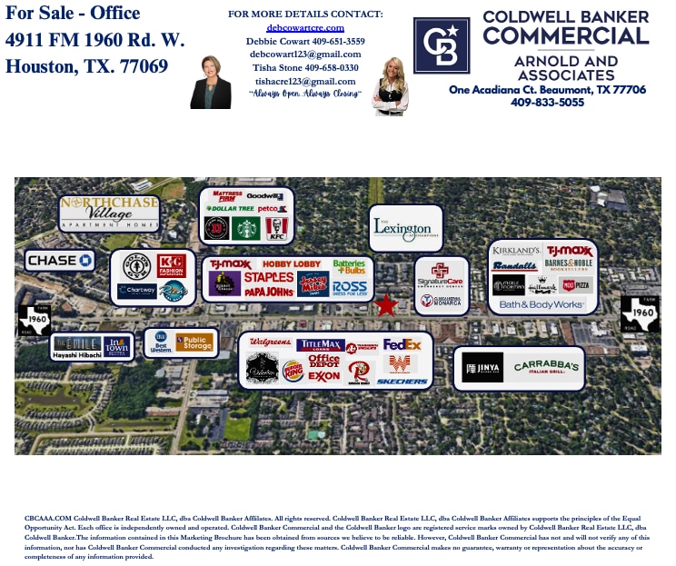
NEARBY MAJOR RETAILERS


PROPERTY TAXES
| Parcel Number | 1043410000020 | Improvements Assessment | $2,437,792 |
| Land Assessment | $1,440,440 | Total Assessment | $3,878,232 |
PROPERTY TAXES
Parcel Number
1043410000020
Land Assessment
$1,440,440
Improvements Assessment
$2,437,792
Total Assessment
$3,878,232
MAP
ADDITIONAL PHOTOS
 Screen Shot 2025-05-27 at 8.46.30 AM
 Screen Shot 2025-05-27 at 8.46.42 AM
 Screen Shot 2025-05-27 at 8.46.56 AM
 Screen Shot 2025-05-27 at 8.47.30 AM